Selected cards from the original Claude research session. These are source candidates, not a claim that every source shipped. Credit corrections and verification are recorded in the current attribution page.
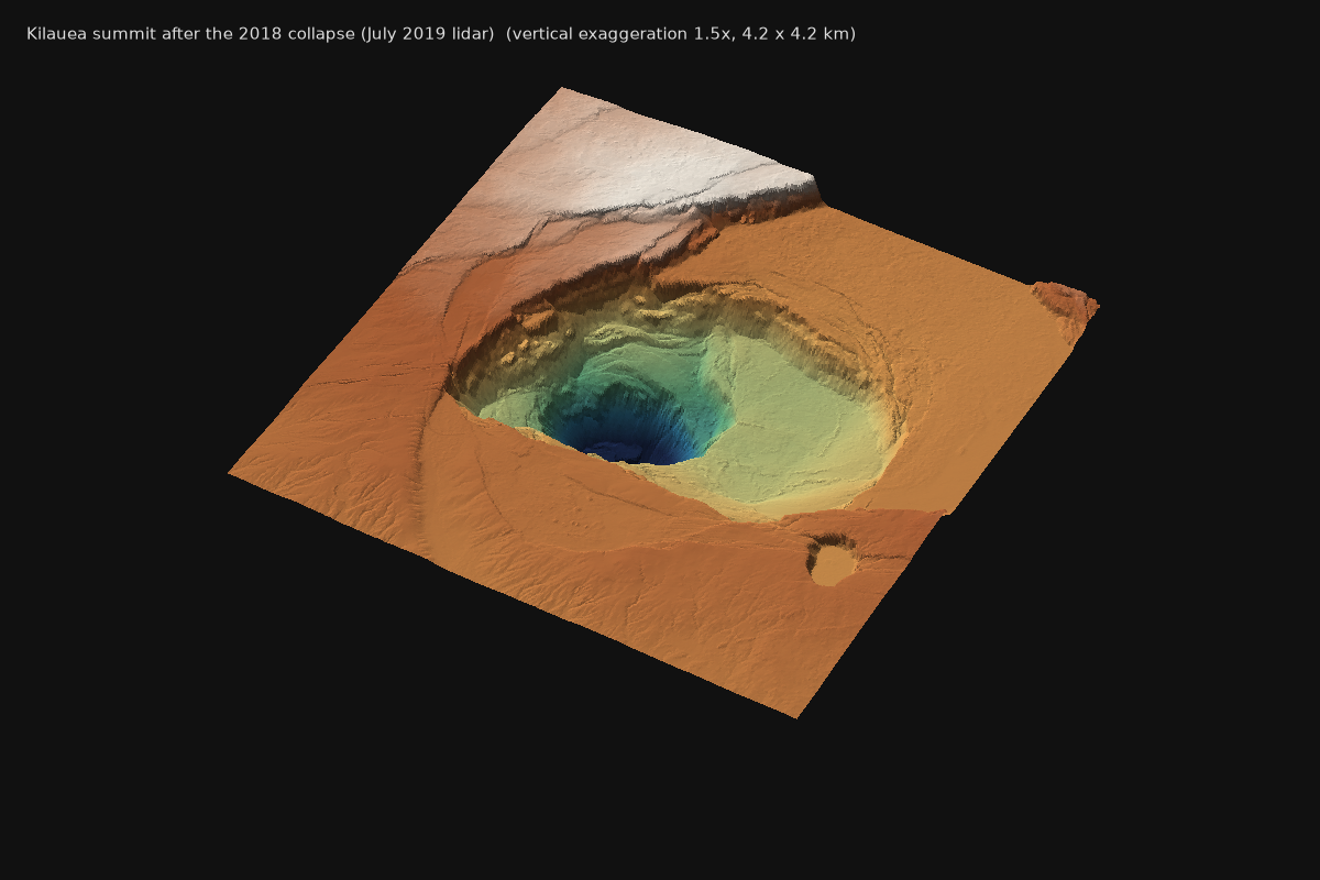
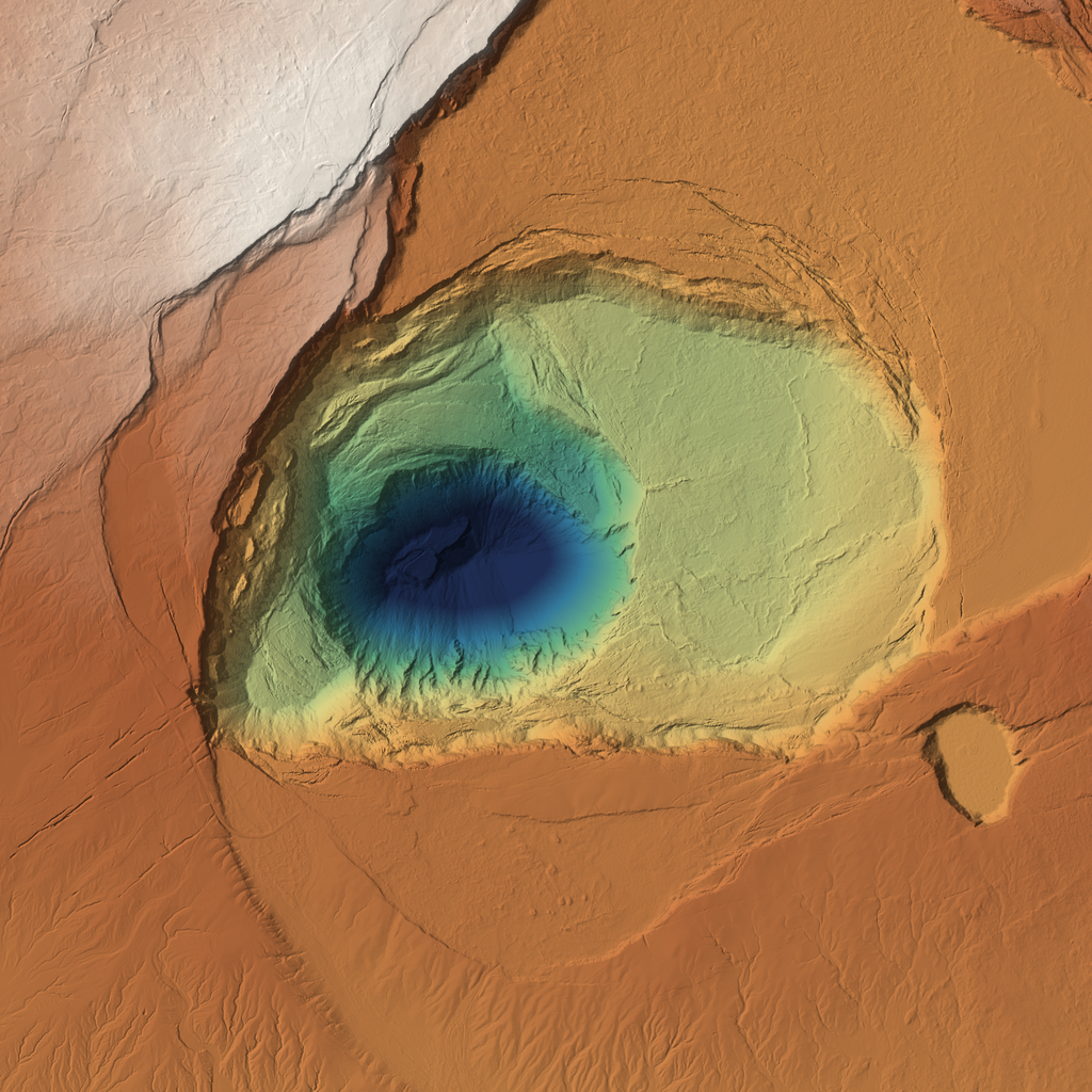
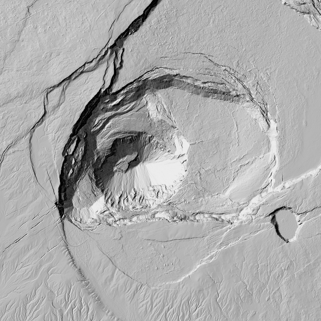
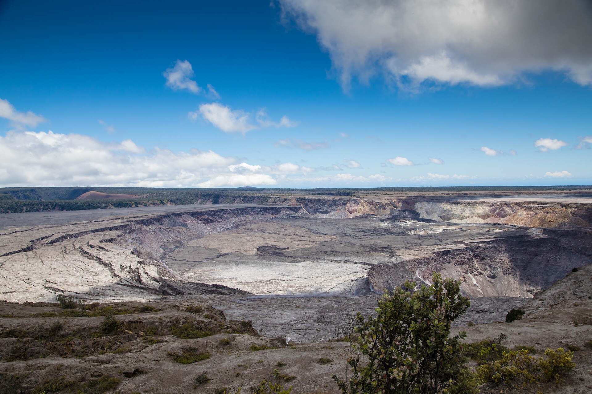
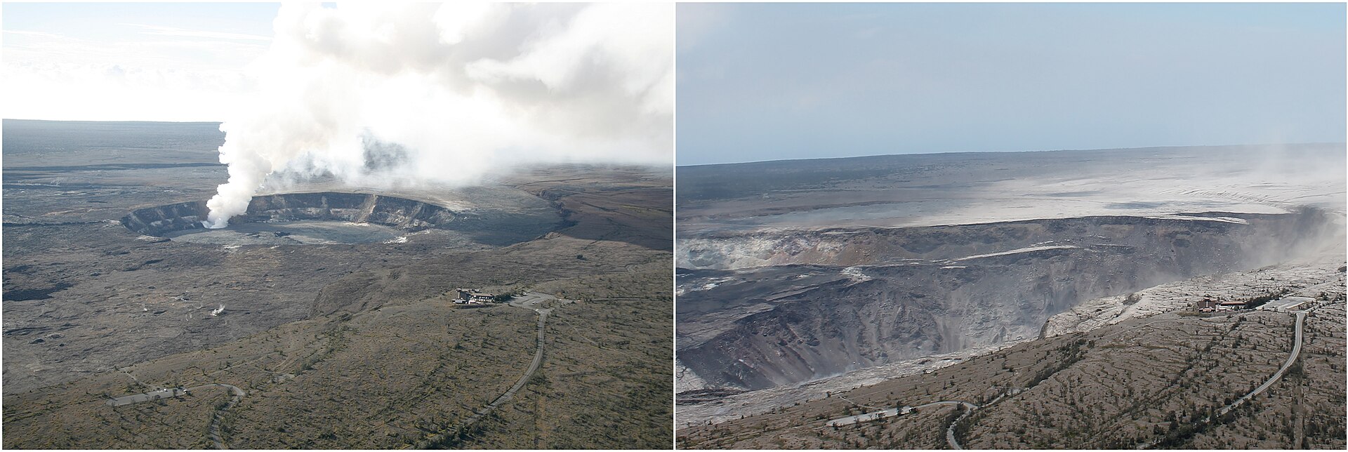
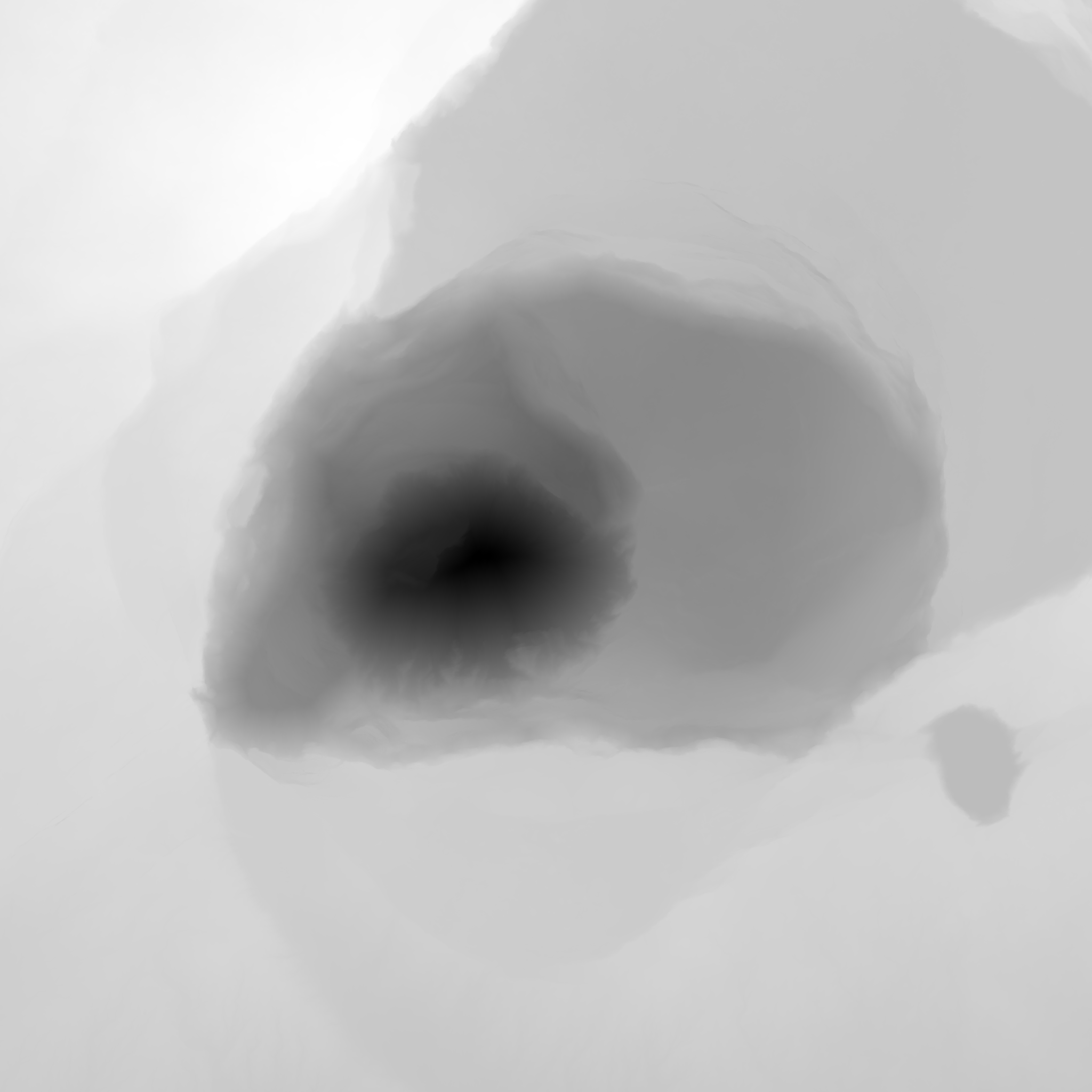
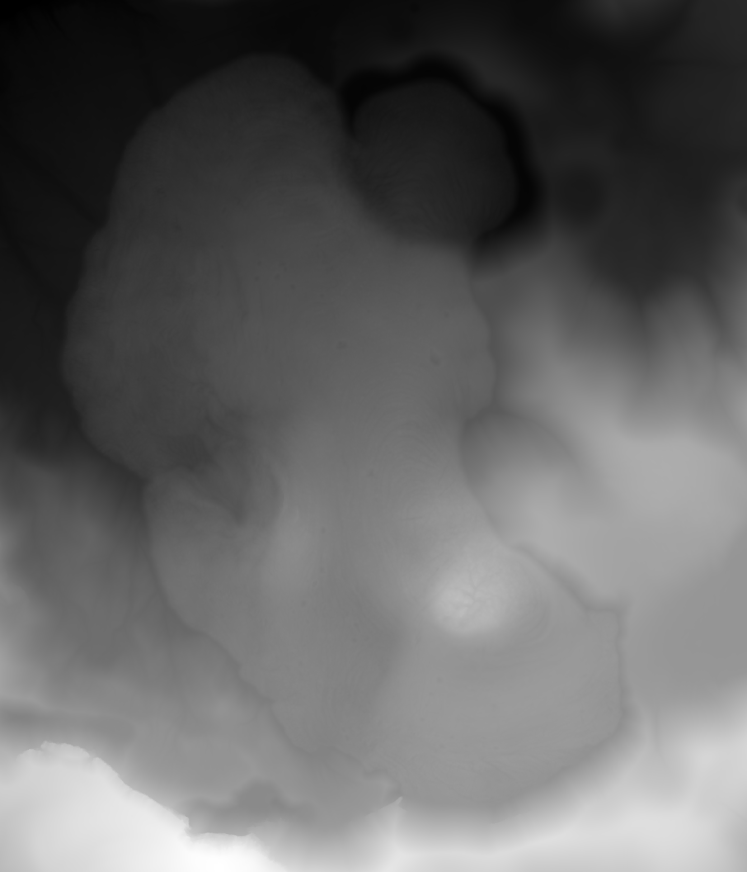
Kilauea summit caldera after the 2018 collapse (July 2019 lidar)
samplehawaii
Kilauea summit, Halema'uma'u and the 2018 down-dropped block, Hawai'i (19.405 N, 155.28 W) · lidar point cloud (USGS 3DEP EPT), gridded by us to a DEM raster · 1 m grid from ground-class points (EPT levels <= 9, ~0.6 ground pts/m2 used; 41% of 1 m cells hit directly, rest inverse-distance filled). Full survey: ~4 ground pts/m2 (USGS metadata). · Sample crop 4.2 x 4.2 km (EPSG:6635 258500-262700 E, 2145400-2149600 N); survey covers Kilauea summit and both rift zones.
Top pick. The final 2018 collapse: a ~500 m deep inner pit inside a ~2 x 3 km down-dropped block bounded by stepped ring faults and slump benches. Matches the brief's 'stepped patera walls' and 'collapse benches' exactly. Best for layout of a patera margin and for cutting wall modules (bench rims, talus slopes, fault-step terraces). Walls are slightly noisy at 1 m because of fill; a full-density (depth 11+) re-grid would sharpen them.
Licence: Public domain (US Government work, USGS 3DEP) · Credit: U.S. Geological Survey, 3D Elevation Program lidar point cloud HI_Volcano_B1_2019 (July 2019), public domain, read from the Entwine Point Tile at s3://usgs-lidar-[path removed] Same survey as Mosbrucker, A.R., Zoeller, M.H., and Ramsey, D.W., 2020, Digital elevation model of Kilauea Volcano, Hawai'i, based on July 2019 airborne lidar surveys: USGS data release, https://doi.org/10.5066/P9F1ZU8O. DEM gridded by us from ground points. · ~1.3 GB of EPT LAZ tiles for this 17.6 km2 crop at depth 9 (cached in raw/); DEM crop 50 MB.
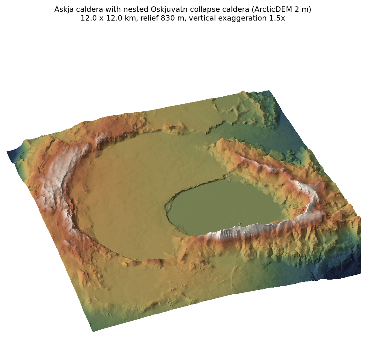
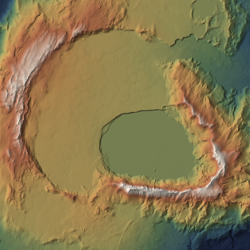
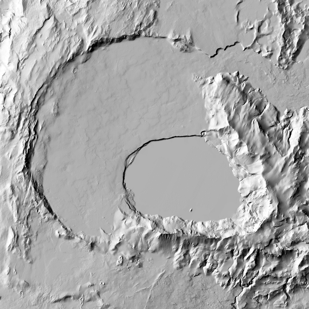
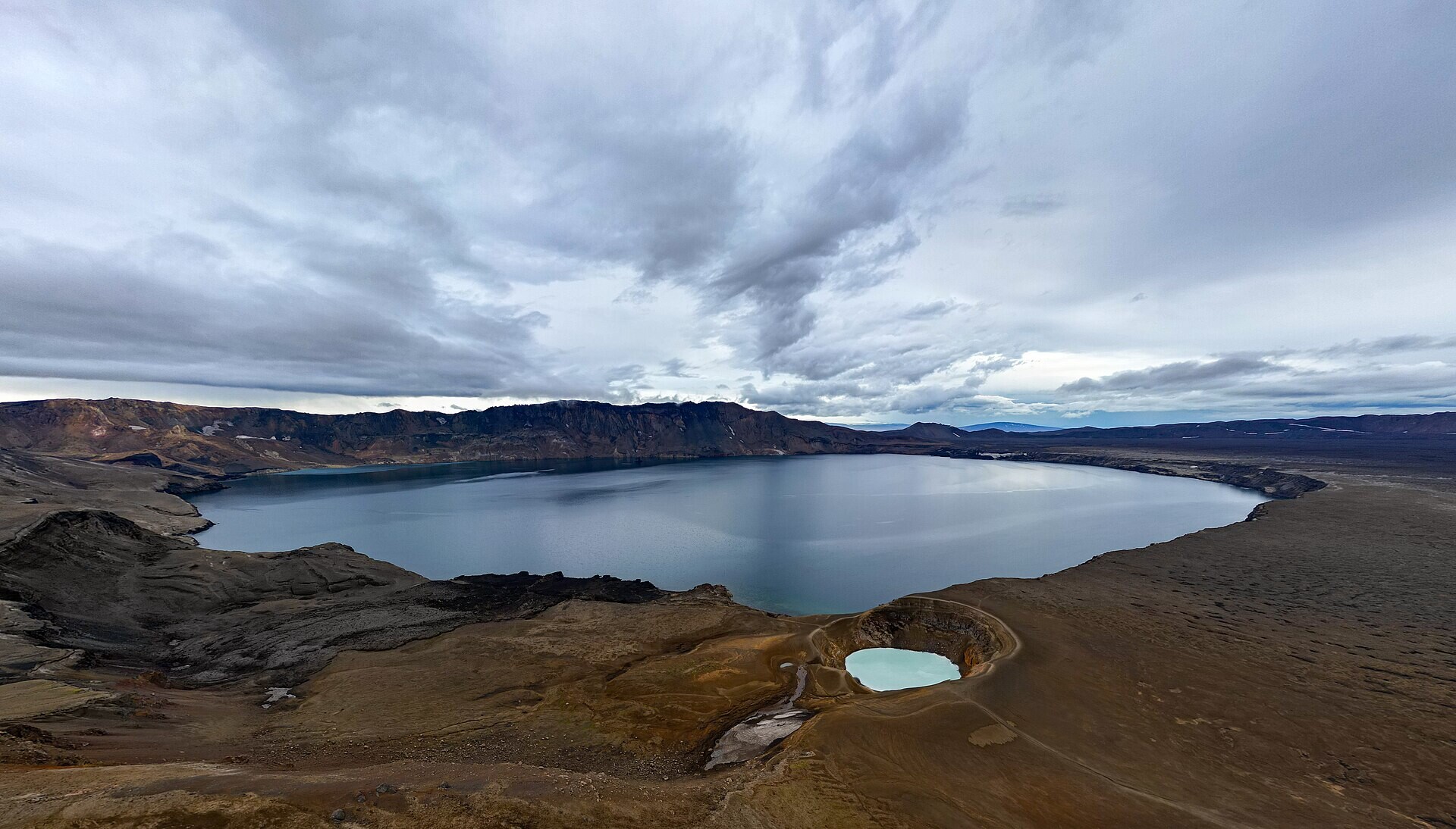
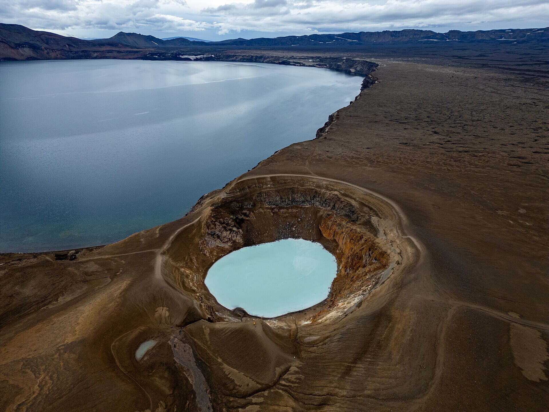
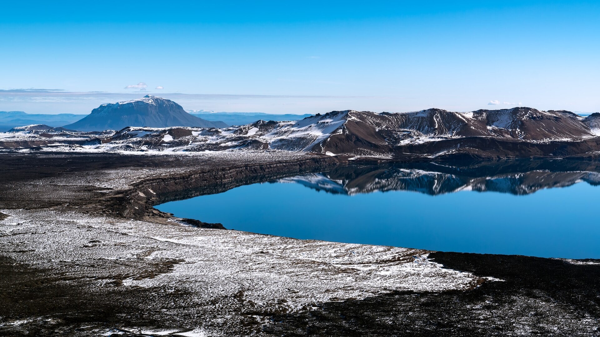
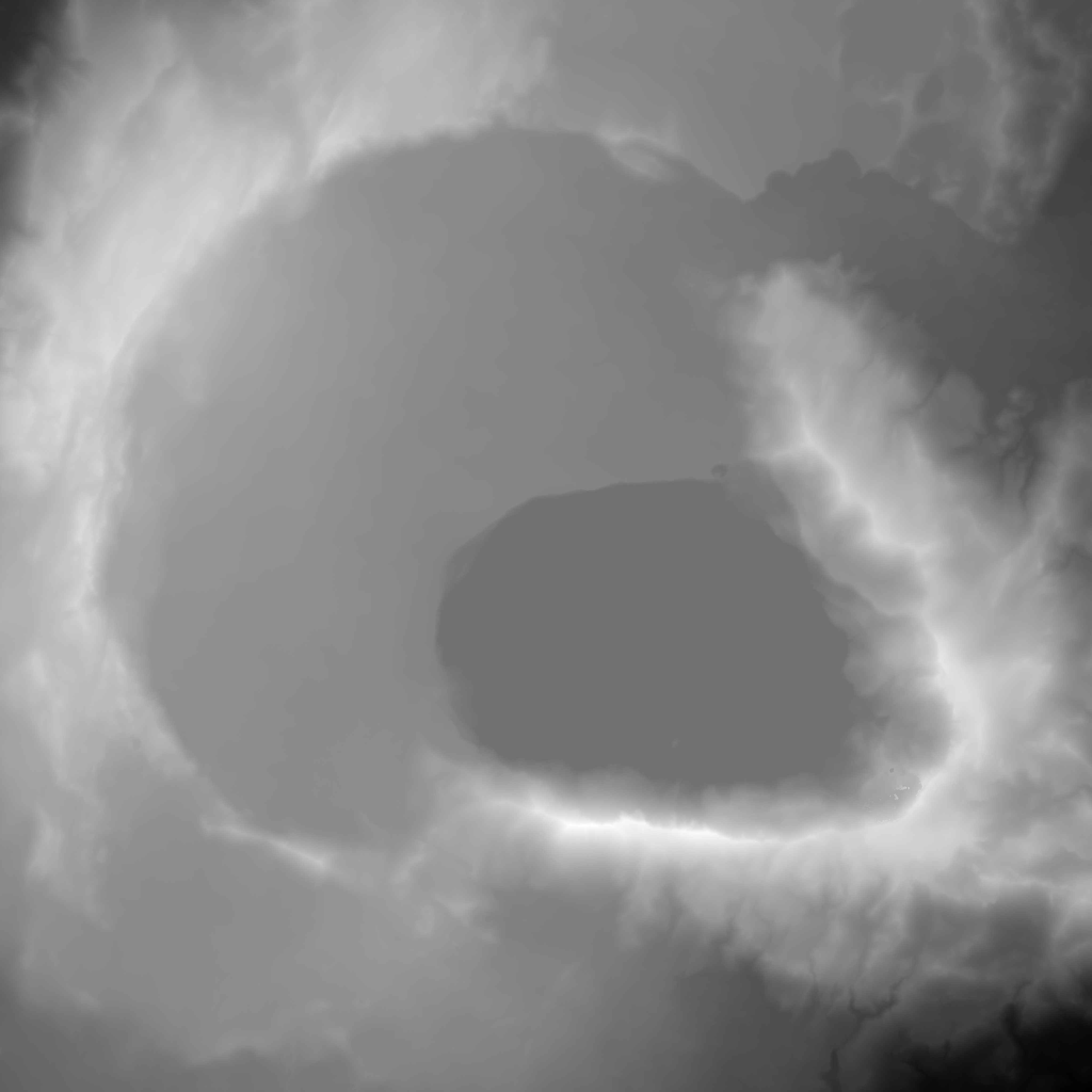
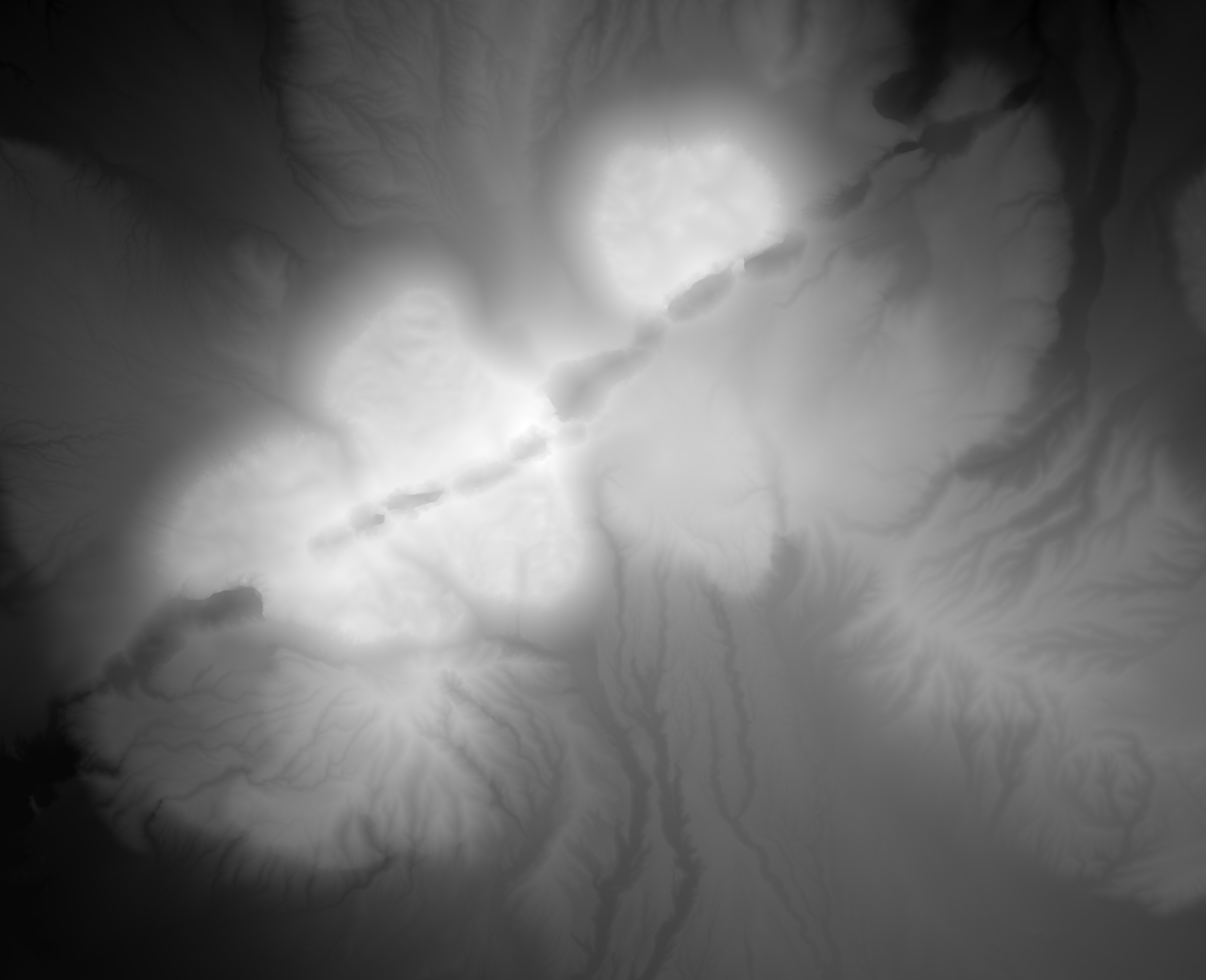
Askja caldera with nested Oskjuvatn collapse caldera
sampleiceland
Askja, Dyngjufjoll, 65.04 N, 16.77 W · DEM raster (ArcticDEM mosaic) · 2 m (heightmap16 2.93 m/px) · 12 x 12 km
LokiTvashtarcaldera rim scarpnested collapse caldera (1875)flat caldera floor / lake surfaceViti explosion crater1961 lava flows (N floor)
oblique 3Dcolour reliefhillshadephotophotophoto
Best patera analogue in Iceland: an ~8 km caldera with a flat floor, a 200-300 m rim, and a younger, steeper, nested collapse basin whose flat lake surface reads like Loki's crusted lake abutting a steep wall. Great for layout (Loki western wall + lake) and stepped wall modules (Tvashtar). Water surface is flat in the DEM. Higher-res drone/Pleiades DEMs exist (Zenodo 12686925).
Licence: CC BY 4.0 · Credit: ArcticDEM Mosaics v4.1, Porter et al. 2023, Polar Geospatial Center, doi:10.7910/DVN/3VDC4W (CC BY 4.0). DEMs provided by the Polar Geospatial Center under NSF-OPP awards 1043681, 1559691, 1542736, 1810976, and 2129685. · COG on AWS S3, clipped via GDAL /vsicurl (only the crop is read; local clips 3-63 MB)
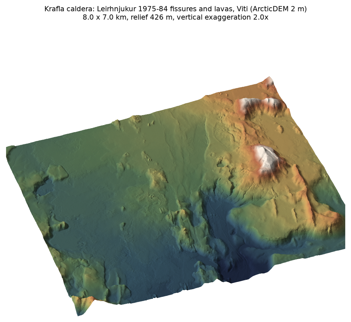
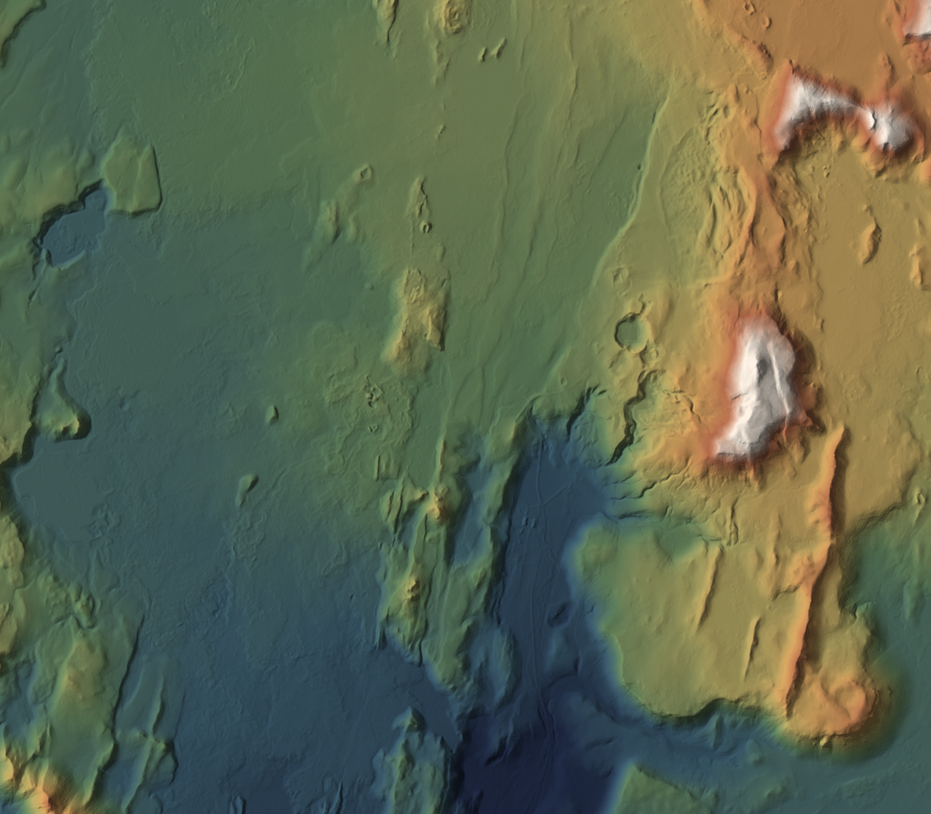
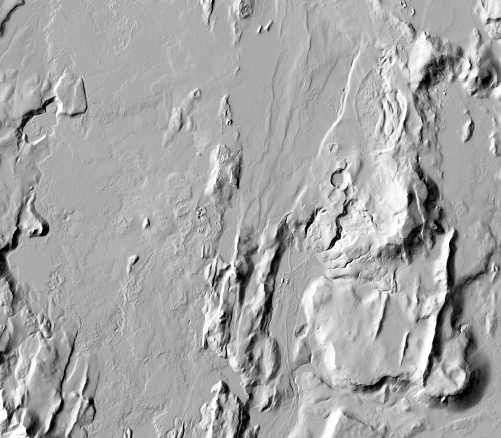
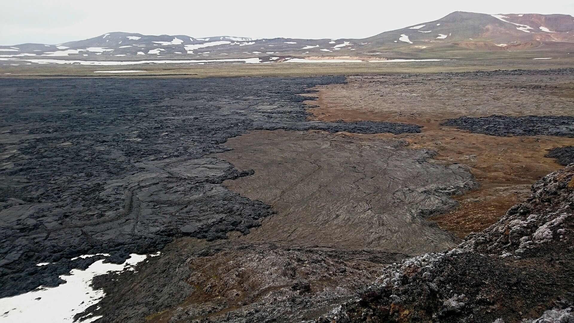
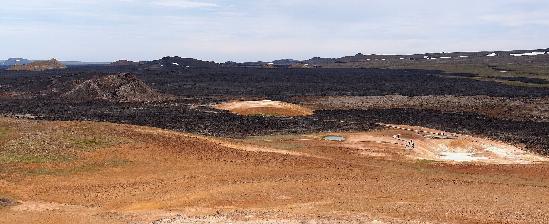
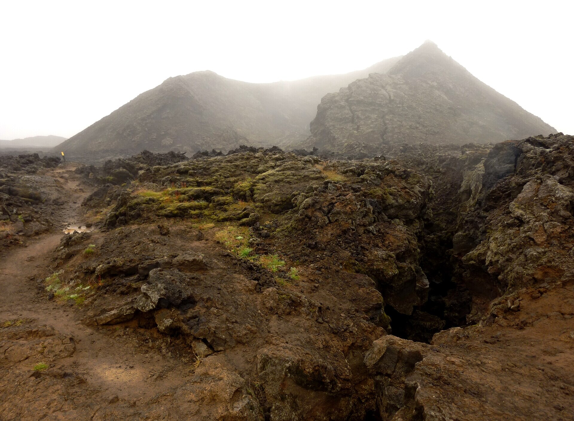
Secondary sample. The fissures and the thin Krafla-fires lavas are subtle at 2 m, while the Viti maar and the fissure ridges read well. Namafjall (5 km S) shows the same swarm more clearly. Steaming and sulfur ground at Leirhnjukur appears in photos only. Contains a power station, pipelines and roads.
Licence: CC BY 4.0 · Credit: ArcticDEM Mosaics v4.1, Porter et al. 2023, Polar Geospatial Center, doi:10.7910/DVN/3VDC4W (CC BY 4.0). DEMs provided by the Polar Geospatial Center under NSF-OPP awards 1043681, 1559691, 1542736, 1810976, and 2129685. · COG on AWS S3, clipped via GDAL /vsicurl (only the crop is read; local clips 3-63 MB)
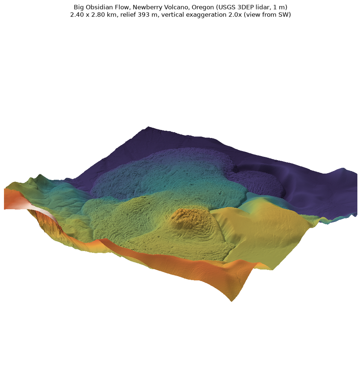
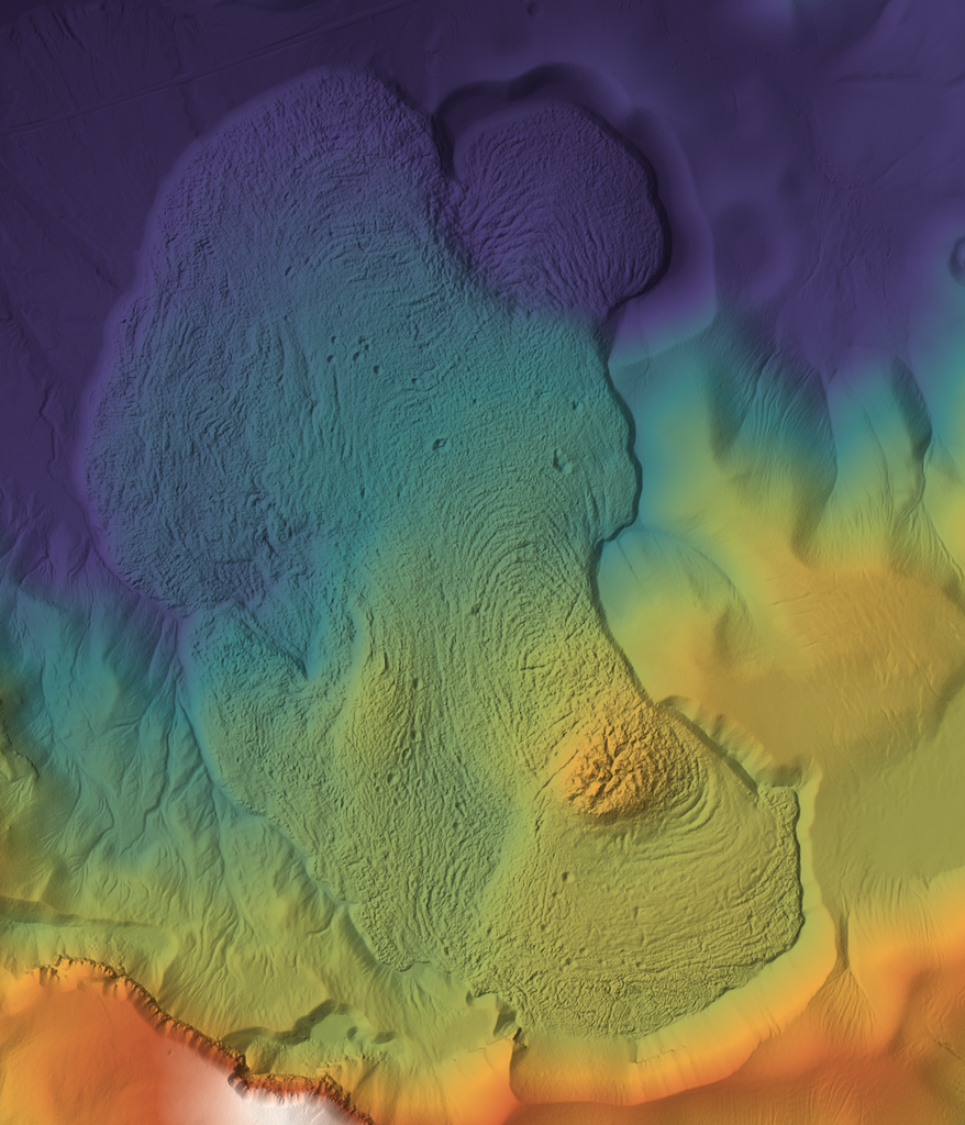
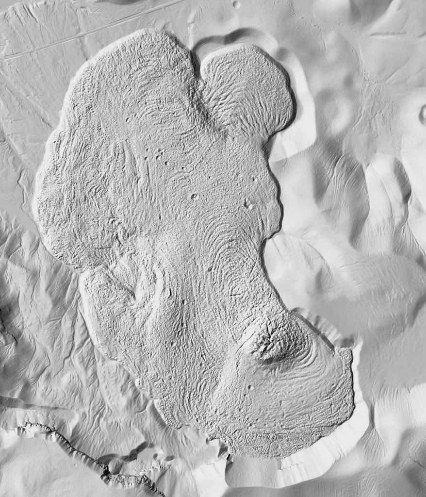
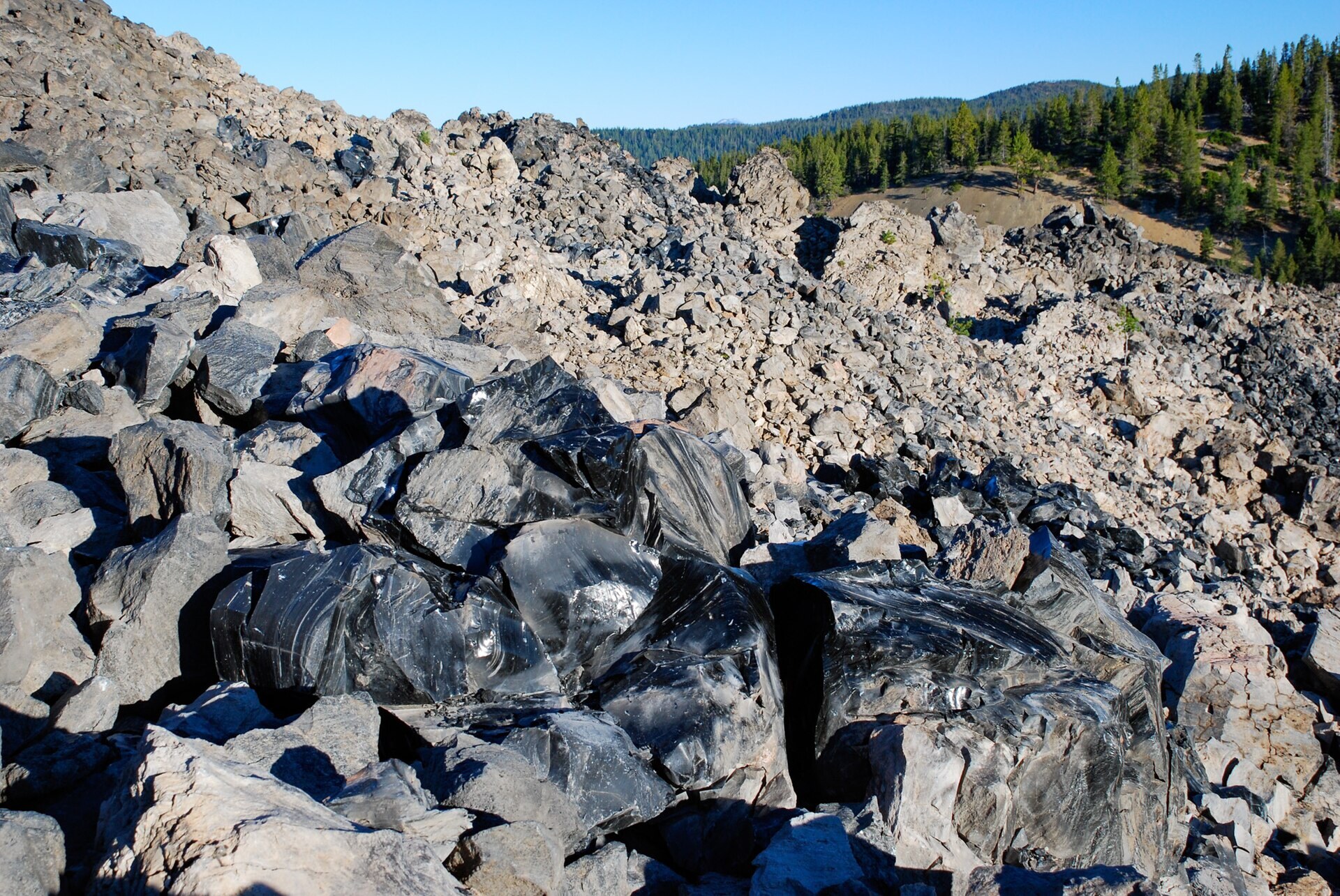
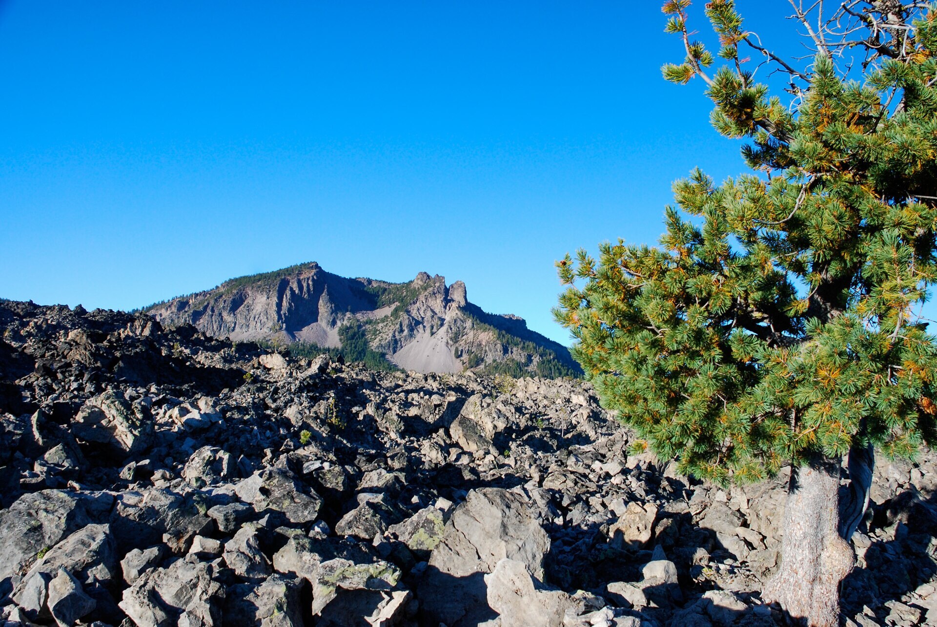
Newberry caldera, Oregon, USA (43.70 N, 121.24 W) · DEM raster (airborne lidar, USGS 3DEP OPR) · native 0.5 m (OPR), sample resampled to 1 m · sample 2.4 x 2.8 km; lidar covers all of Newberry caldera
The cleanest example of concentric flow ridges anywhere: 20-30 m tall blocky flow, arcuate ridges wrapping a vent dome, sharp 20-40 m flow fronts. Great for a fresh-flow layout (Tvashtar) and as a model for platy/ridged flow surfaces on the Loki crust; flow-front faces work as low wall modules. Note: the 1 m 3DEP product is empty here, use the OPR tiles.
Licence: Public domain (U.S. Government work; USGS 3DEP data carry no use restrictions) · Credit: U.S. Geological Survey, 3D Elevation Program (3DEP), accessed 2026-10-12 via The National Map (OPR DEM project OR_Western_D23) · 30 OPR tiles read via /vsicurl (~170 MB transferred); crop 12 MB
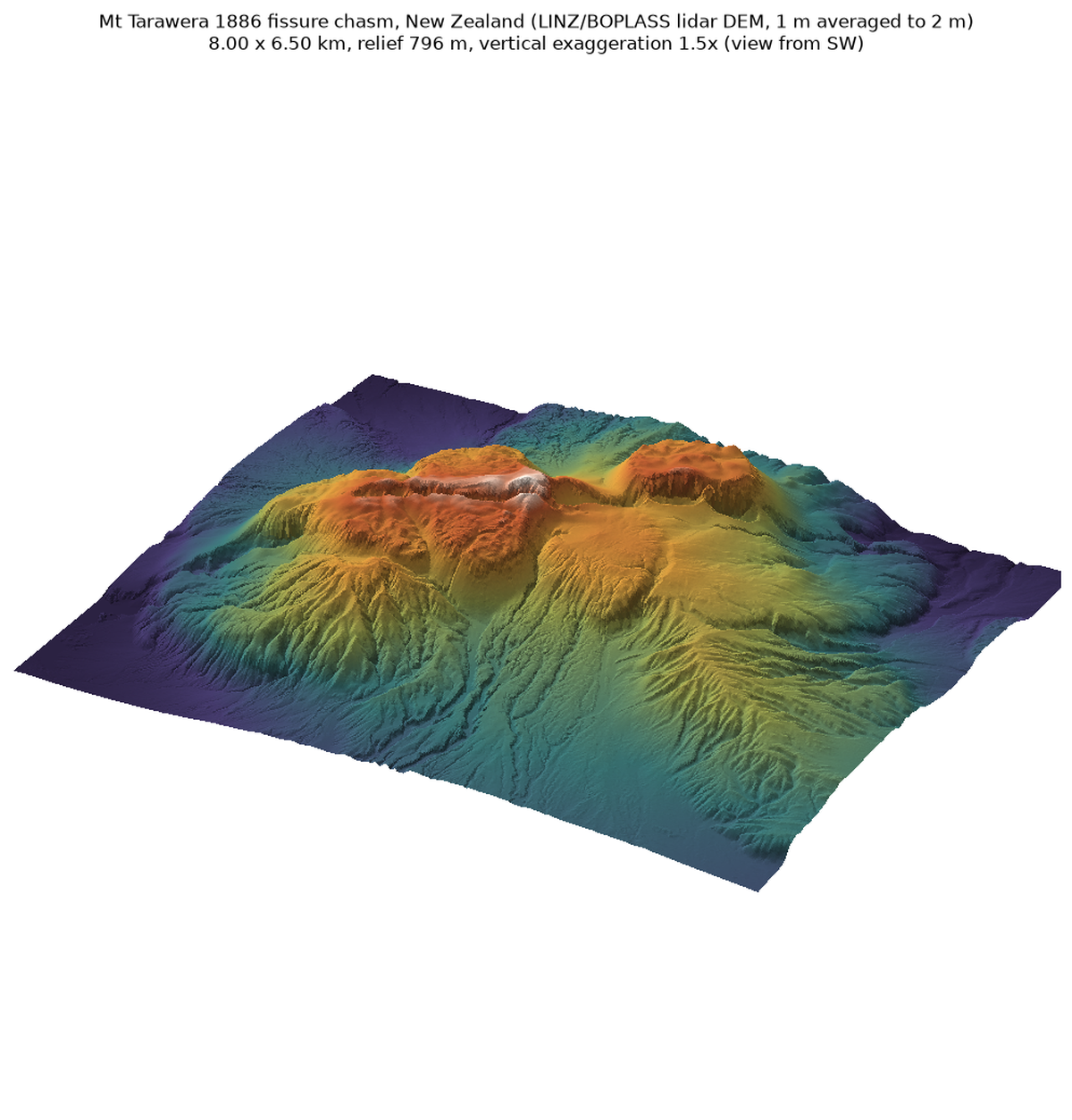
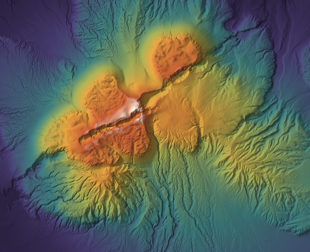
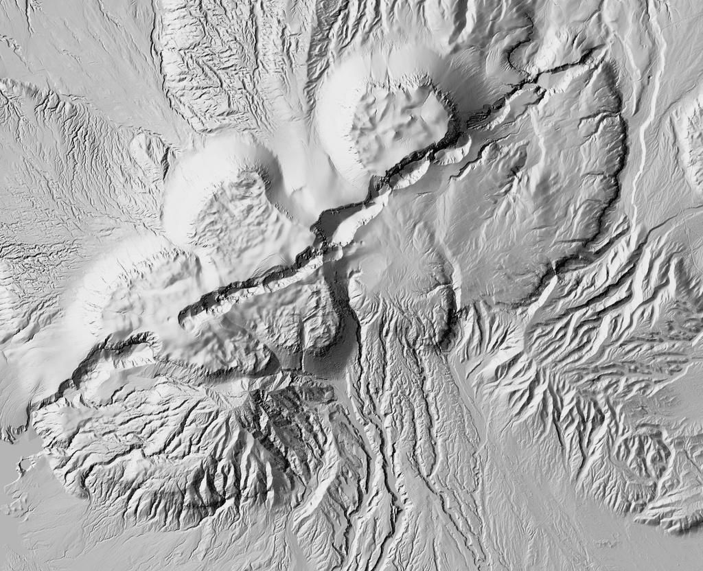
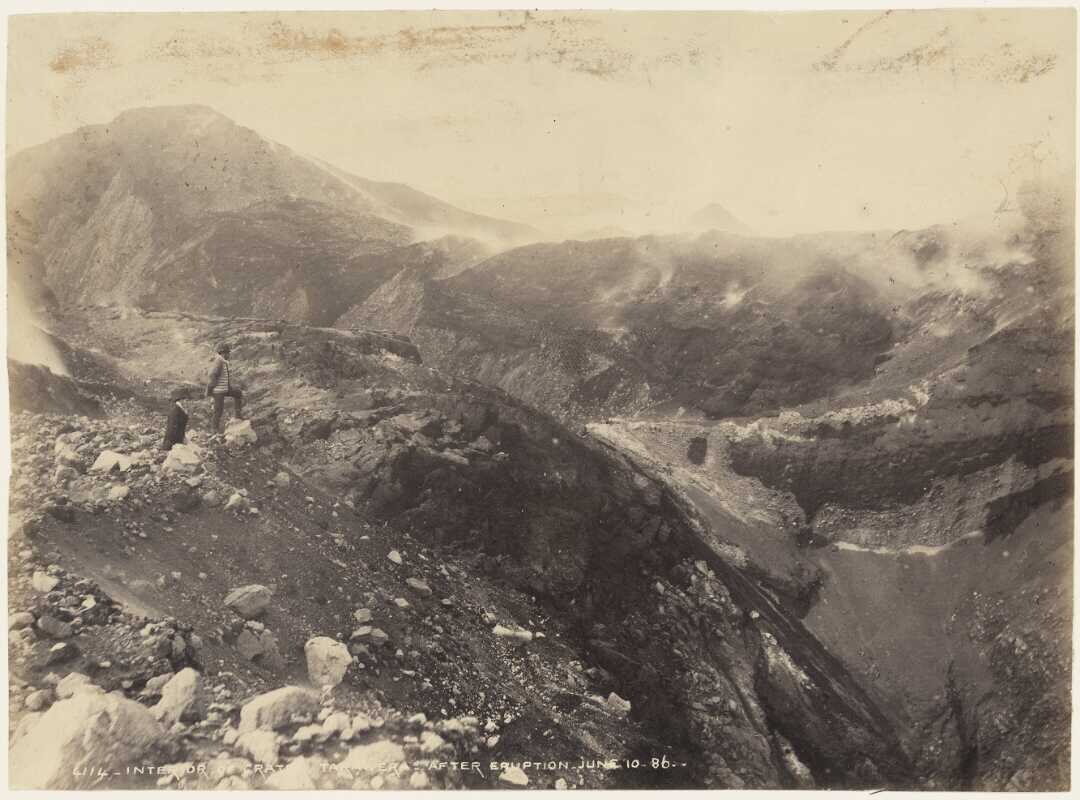
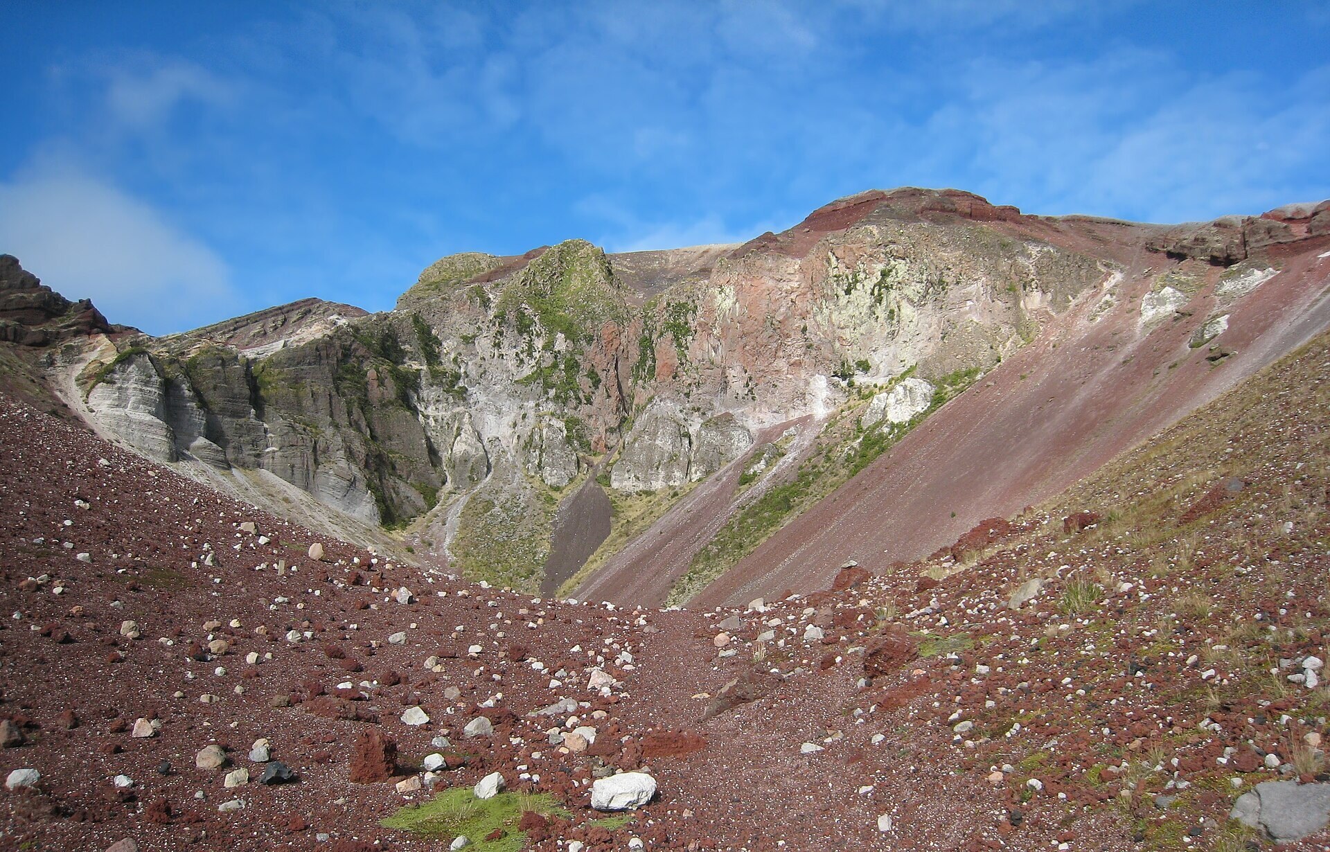
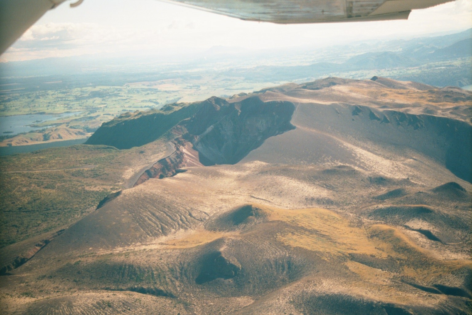
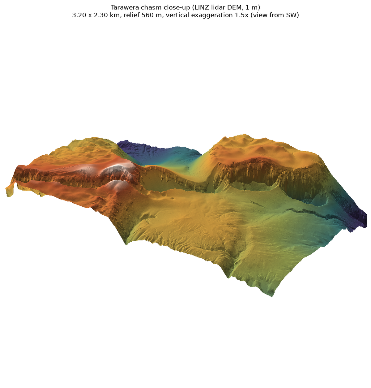
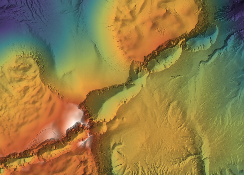
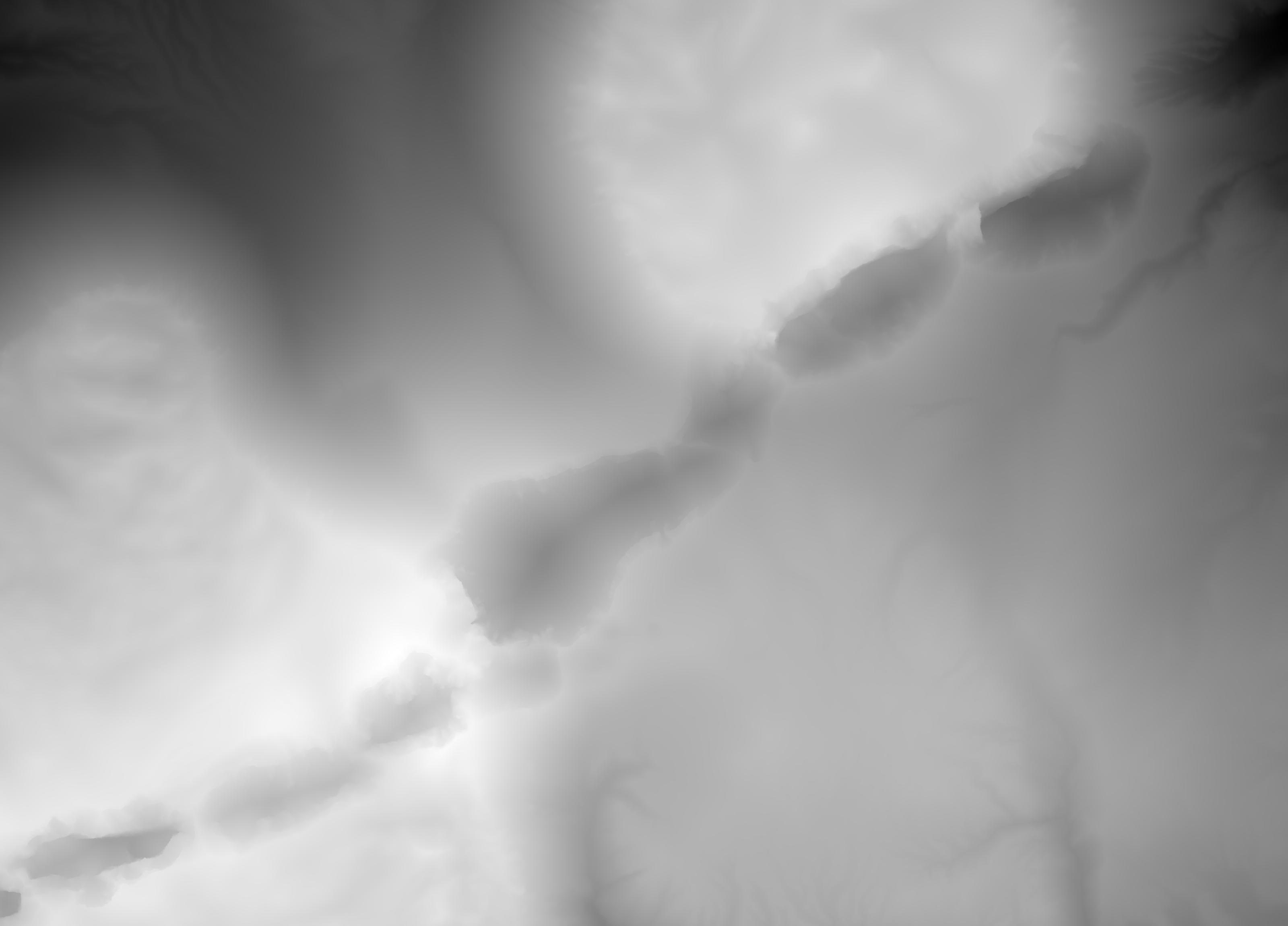
A 1886 basaltic fissure eruption ripped a 6+ km chain of joined craters, 100-250 m deep with near-vertical walls, straight through a dome plateau. Best fissure-wall source found: for Tvashtar both the layout (en-echelon segments) and the wall modules. Owner prefers sharp cliffs, and these are lidar-sharp.
Licence: CC BY 4.0 (licensor BOPLASS, hosted by Toitu Te Whenua LINZ) · Credit: Bay of Plenty LiDAR 1m DEM (2019-2022), BOPLASS / Toitu Te Whenua Land Information New Zealand, licensed under CC BY 4.0 (s3://nz-elevation) · COG range reads (needs a GDAL with LERC; the rasterio wheel has it, the system GDAL CLI does not); crop 40 MB
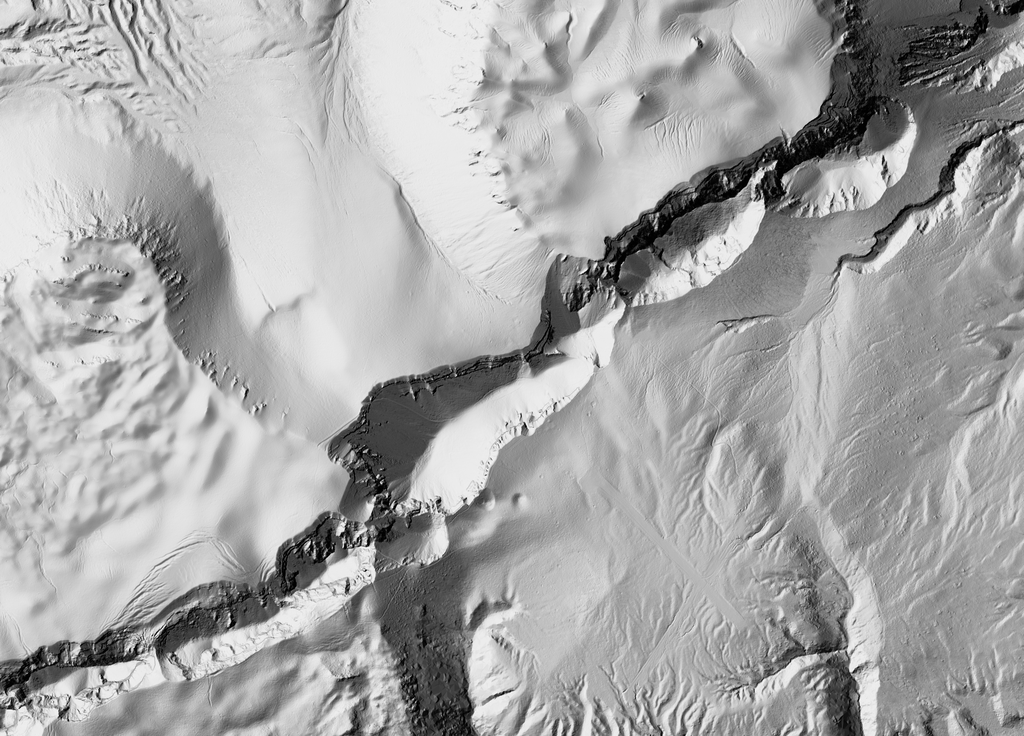
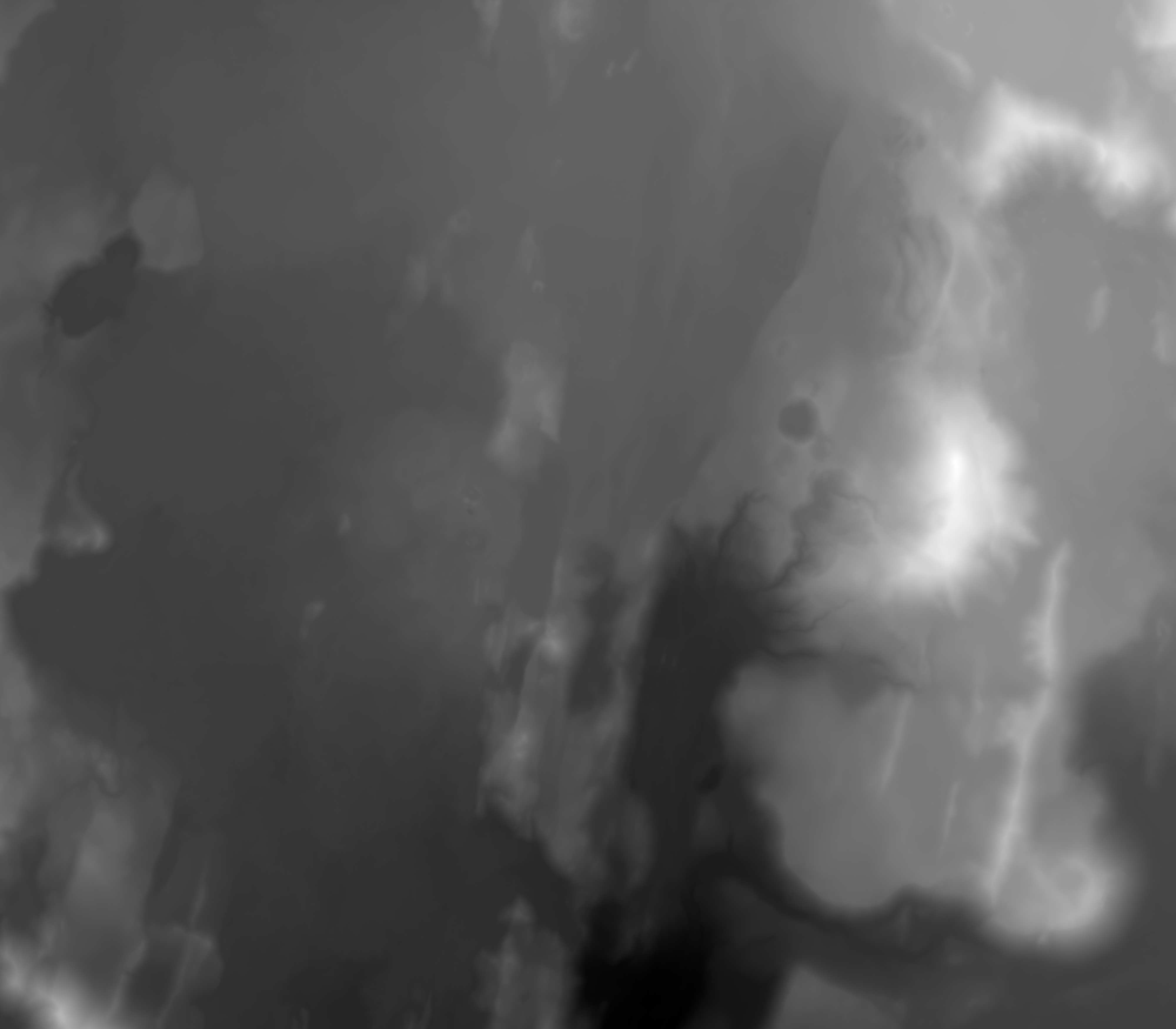
Mt Tarawera summit, New Zealand (38.23 S, 176.51 E) · DEM raster (airborne lidar, LINZ) · 1 m · 3.2 x 2.3 km
TvashtarLokifissure crater wallscrater floor talusdome plateau rim
oblique 3Dcolour reliefhillshade
The central chasm at full 1 m: stepped walls 150-250 m high with talus aprons. Cut wall modules here for stepped patera/fissure walls.
Licence: CC BY 4.0 (licensor BOPLASS, hosted by Toitu Te Whenua LINZ) · Credit: Bay of Plenty LiDAR 1m DEM (2019-2022), BOPLASS / Toitu Te Whenua Land Information New Zealand, licensed under CC BY 4.0 (s3://nz-elevation) · crop 25 MB
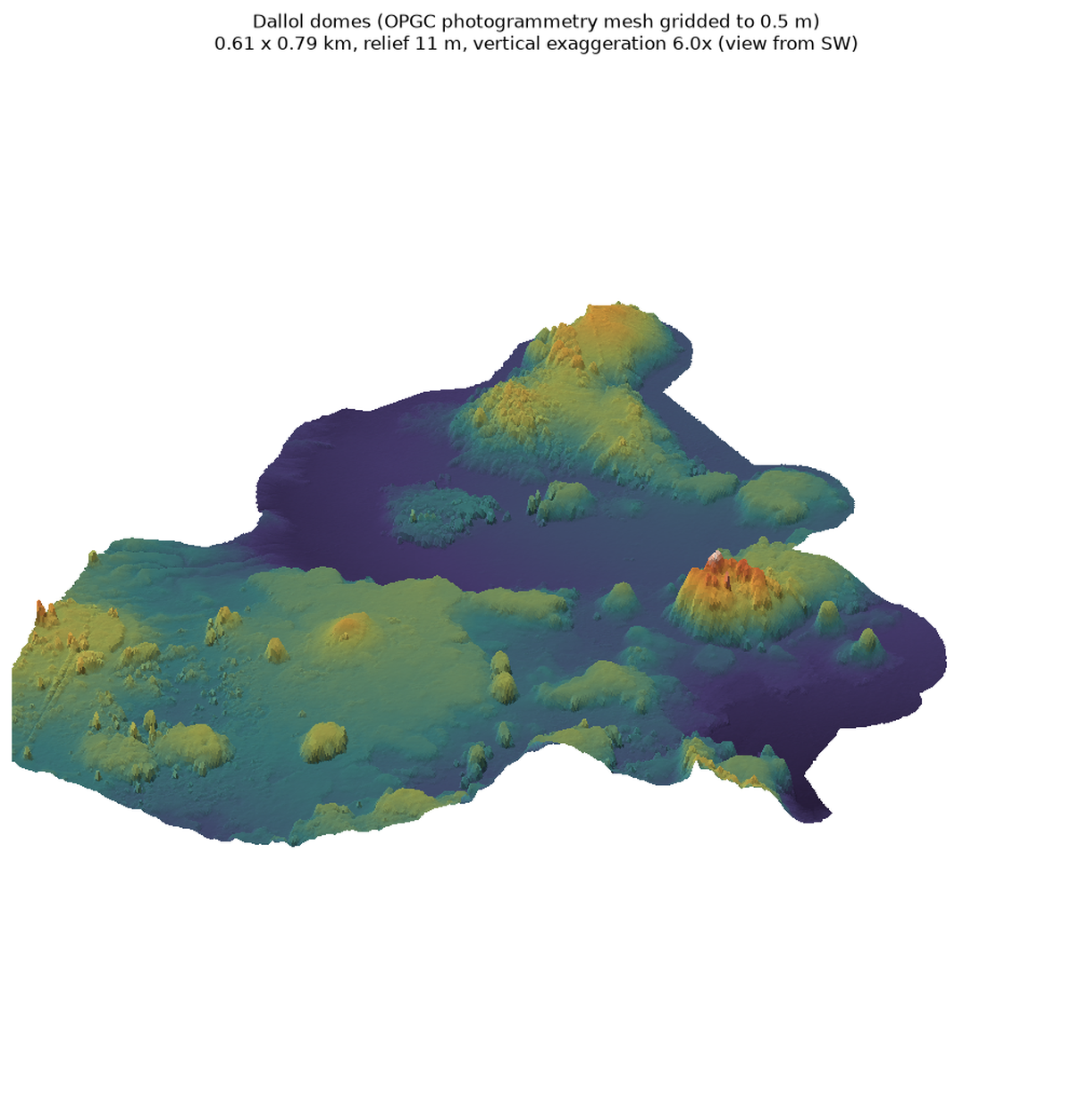
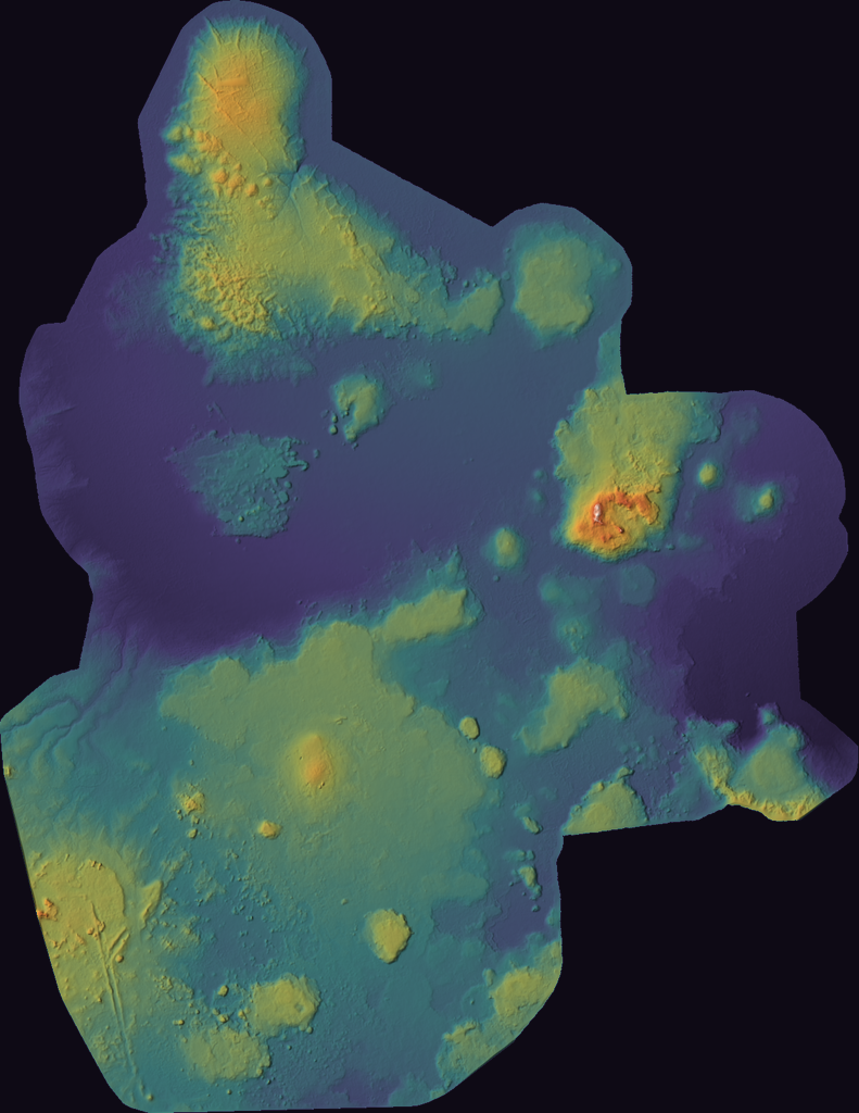
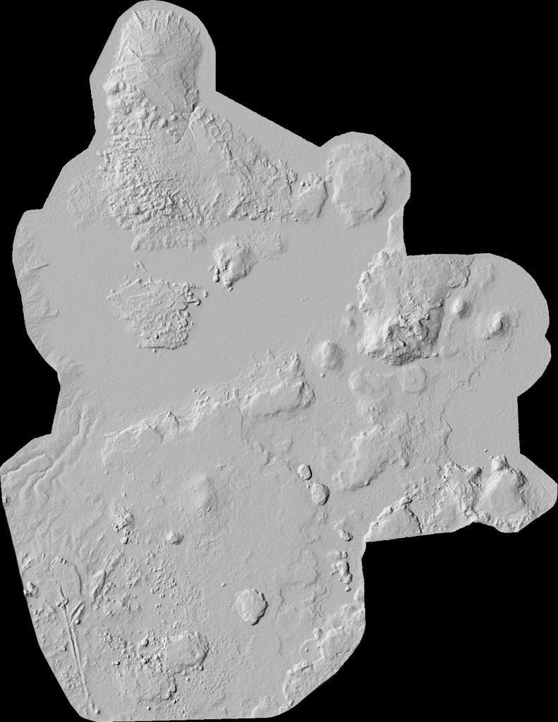
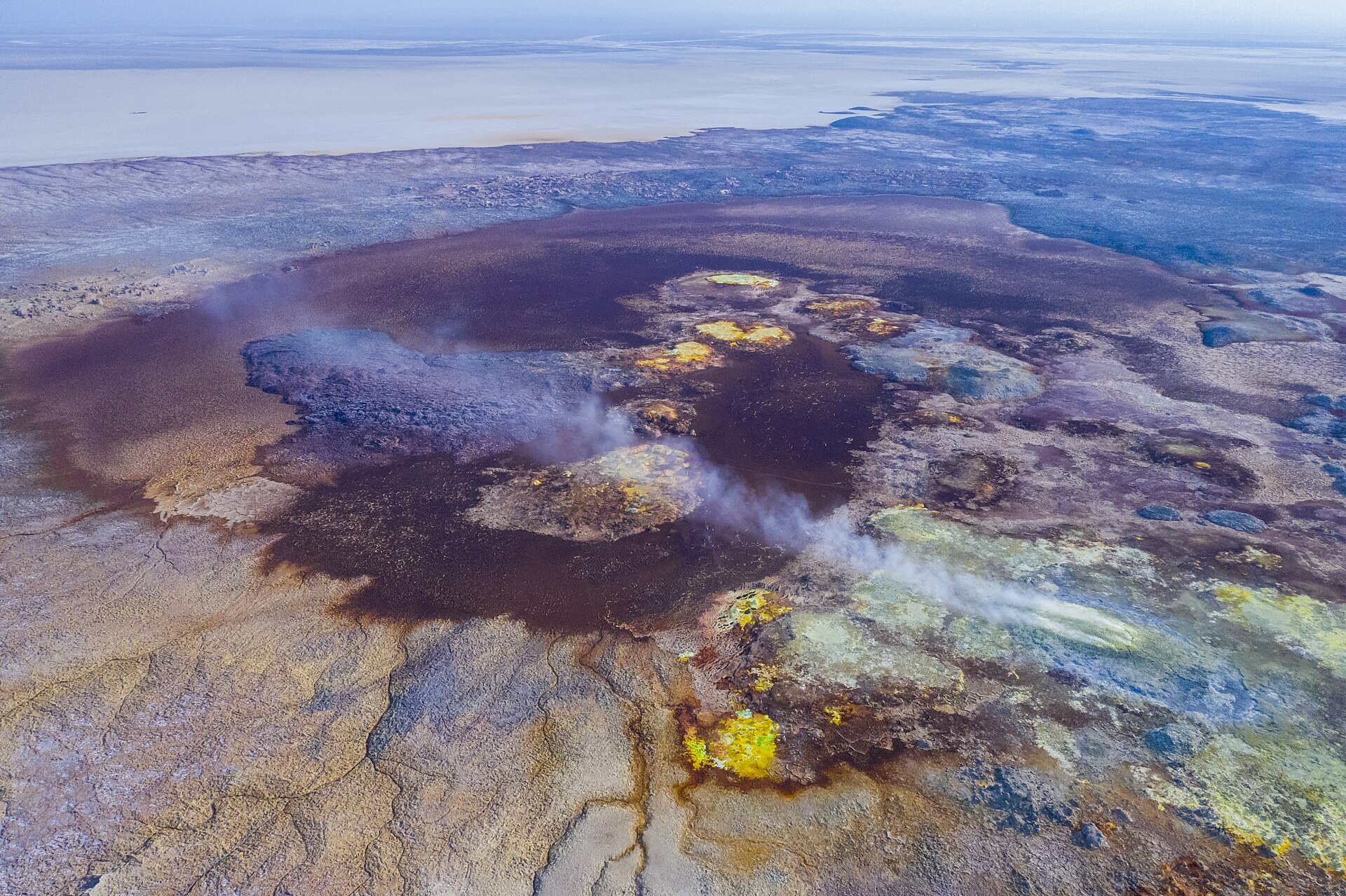
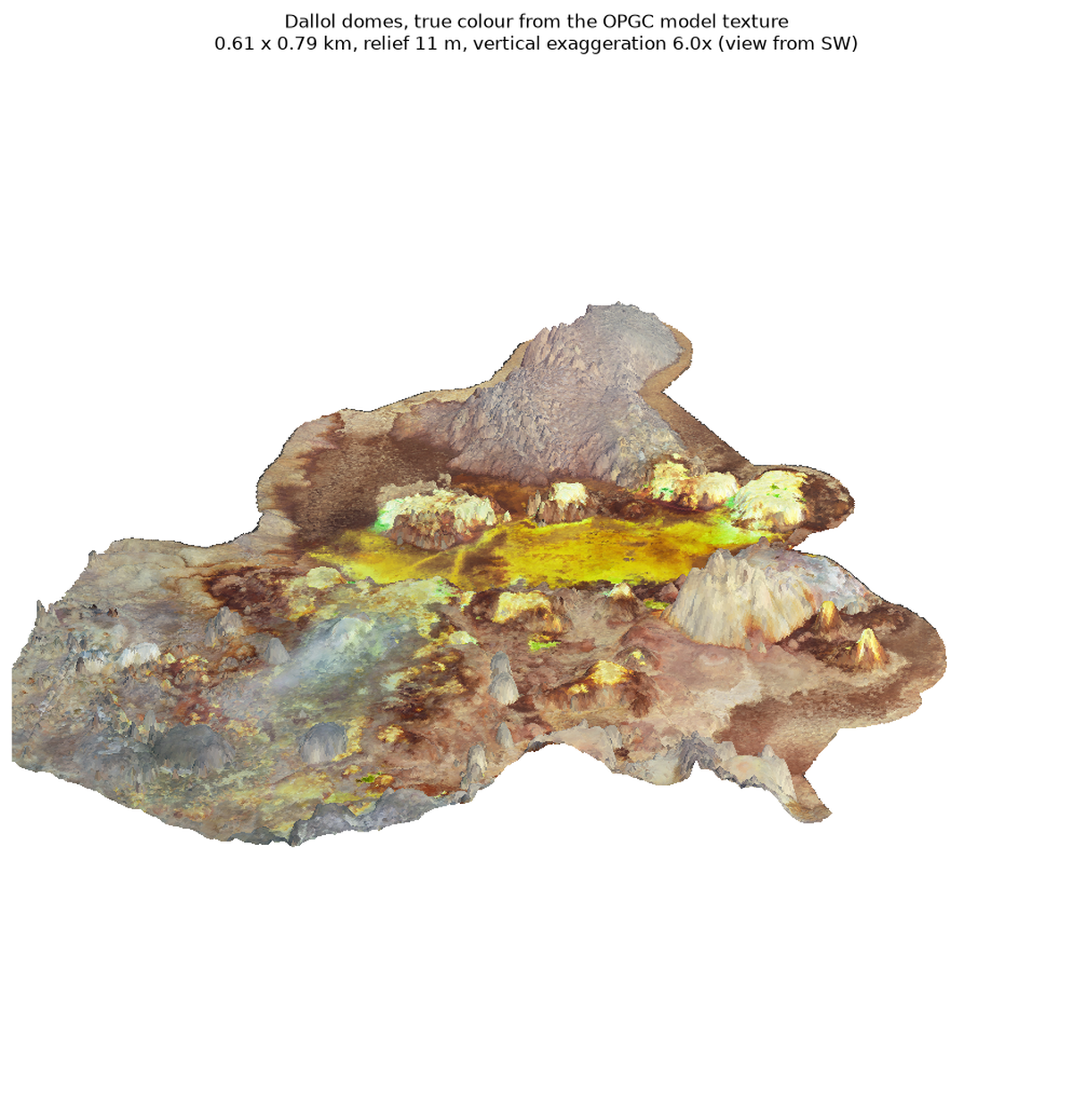
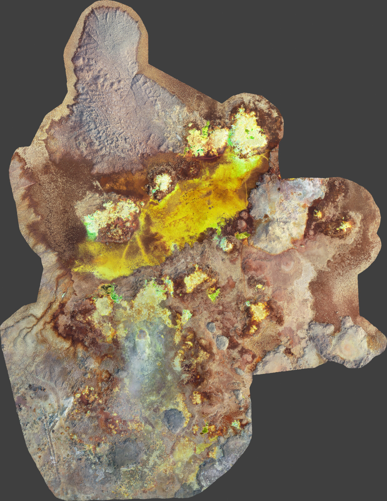
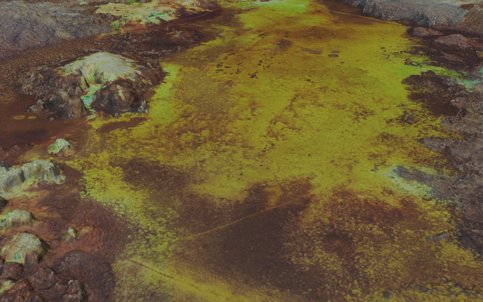
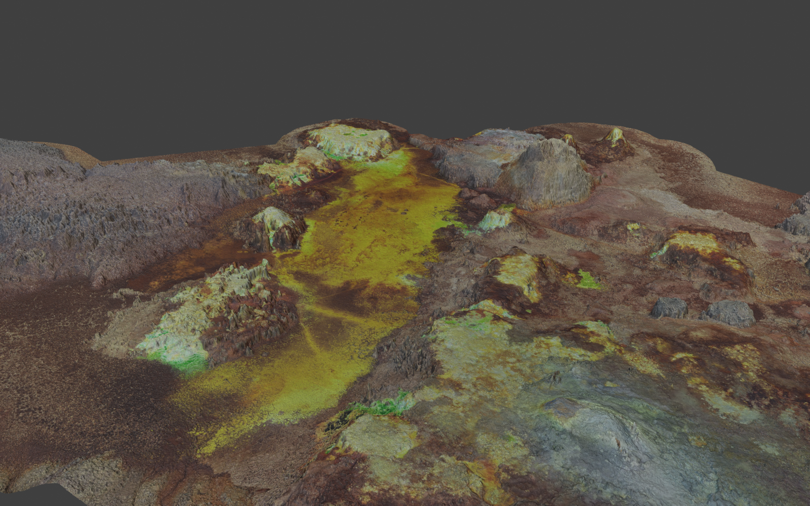
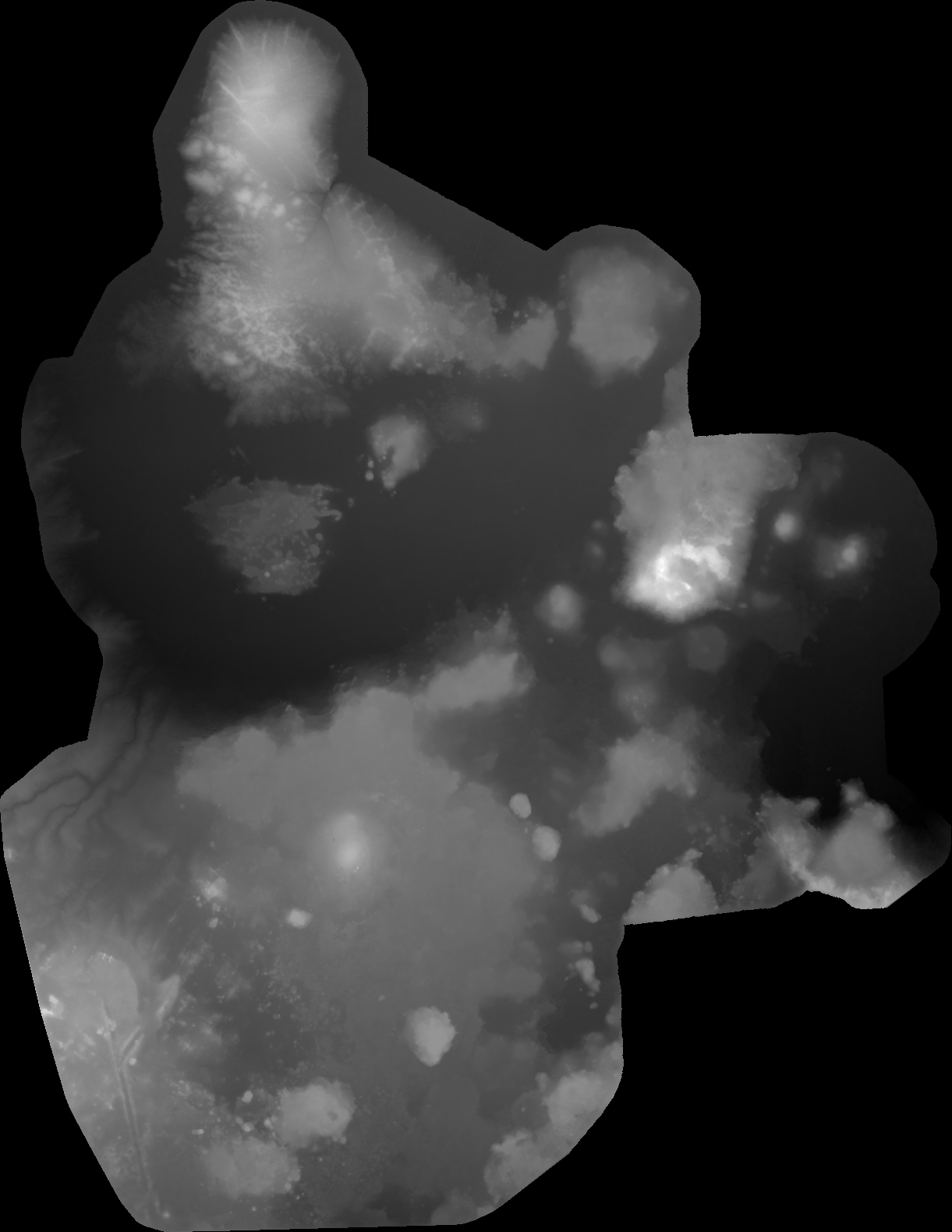
Dallol, Danakil Depression, Ethiopia (14.24 N, 40.30 E) · photogrammetry mesh (textured OBJ, tiled) · LOD quadtree of 48 OBJ tiles (levels a/b/c/d), stated texel resolution 0.245 / 0.122 / 0.061 / 0.031 m, 4096 px JPEG textures; level b = 2.15 M faces, 1.21 M vertices (vertex spacing ~0.5 m); sample DEM gridded at 0.5 m · 0.61 x 0.79 km (local ENU metres, Z up; relief 10.8 m; KML georeference SW corner 40.29528 E, 14.23629 N, base altitude -119.26 m)
Pelesalt/sulfur moundshydrothermal chimneyscolour terracesacid poolssulfur and iron-oxide crusts
oblique 3Dcolour reliefhillshadephotophotophoto
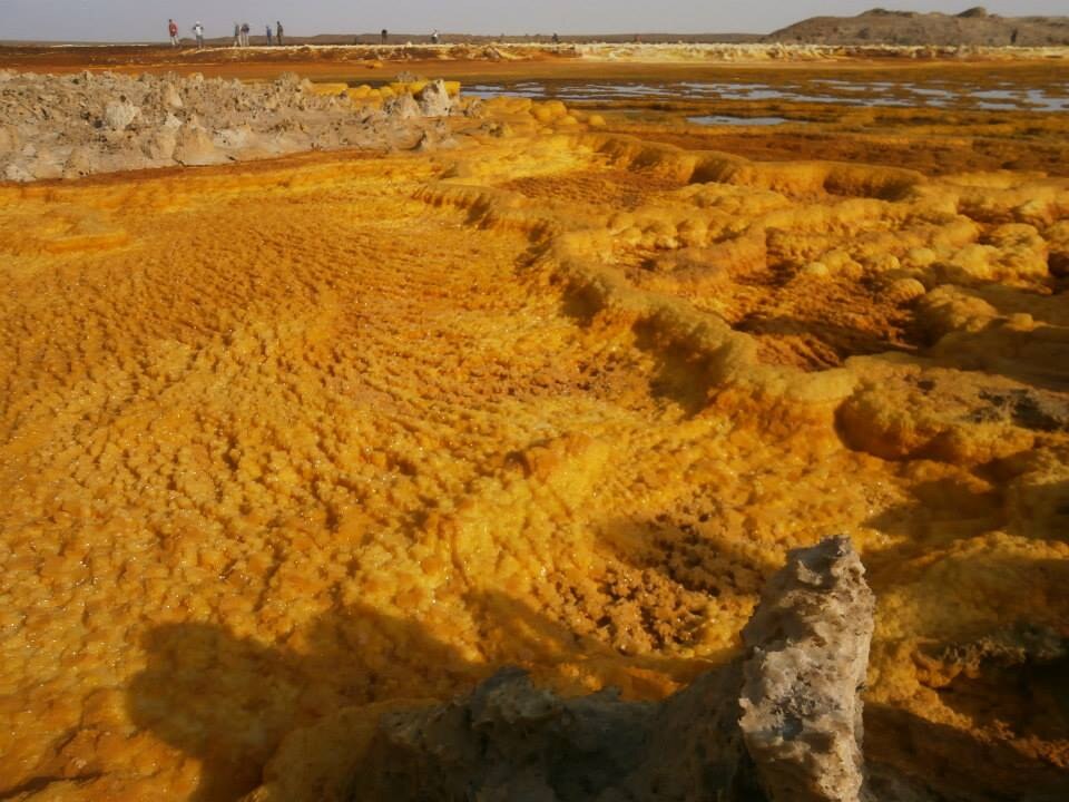
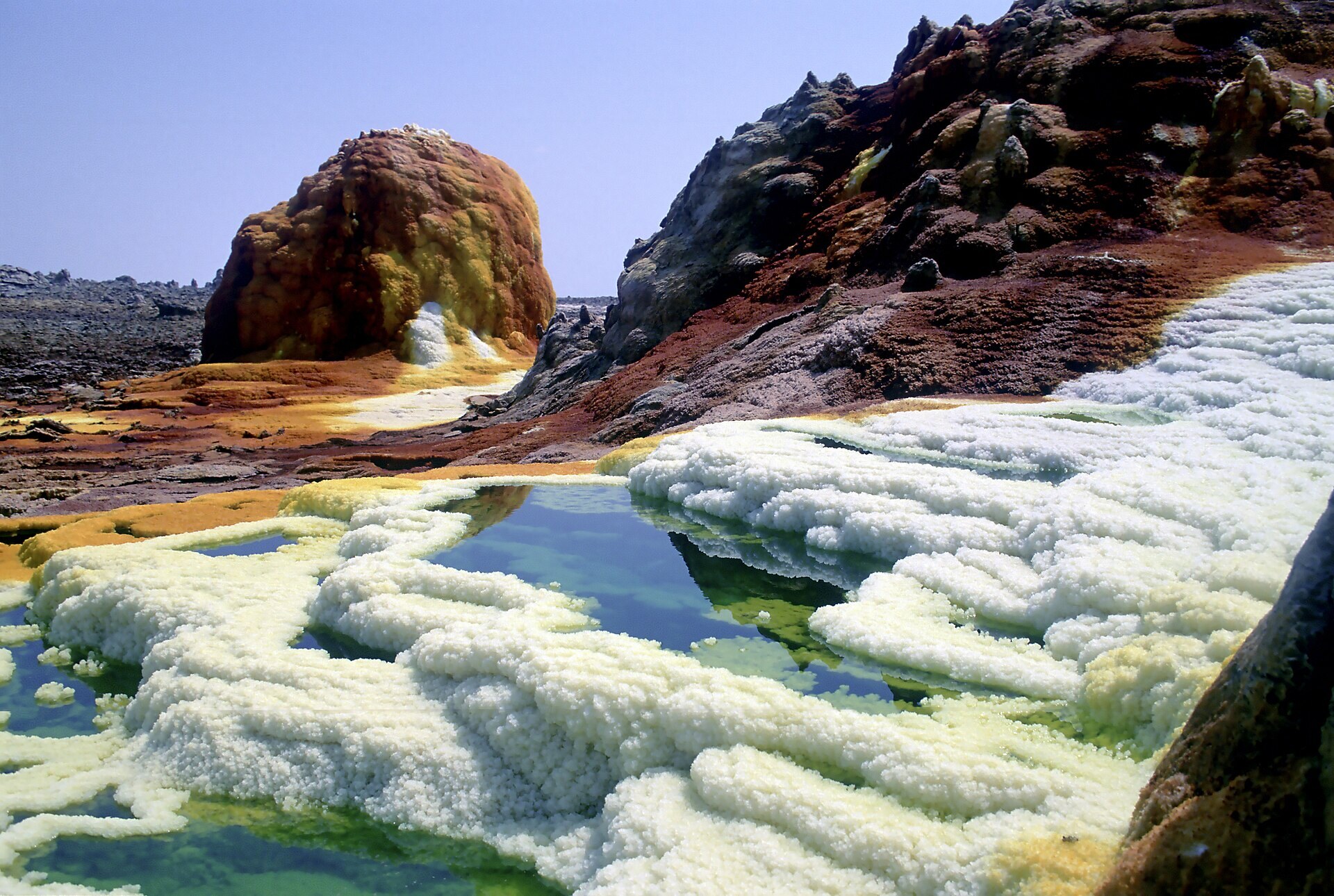
The best sulfur-dressing item found: a full-colour photogrammetric model of Dallol's hydrothermal field, with acid-yellow sulfur and salt pools, orange-brown iron-oxide crusts, white salt pillars and chimneys, and dark mounds. It is Pele's colour palette on real micro-topography. Use it for texture and decal extraction (ortho-truecolour.jpg at 0.33 m/px, or the 4K tile textures at up to 3 cm/texel) and for scatter (cut chimneys and salt-pillar meshes from the level-c/d tiles). The topography is only metres high, so it is not a layout source. Renders: Blender Workbench (ortho-truecolour.jpg, render-oblique.png at 4x vertical exaggeration, render-closeup.png at 2x) and a matplotlib true-colour oblique at 6x.
Licence: CC BY-NC 4.0 · Credit: Grunwald, O.; Delage, E.; van Wyk de Vries, B. Topographic 3D model: Dallol domes - Dataset. OPGC / LMV, Universite Clermont Auvergne. https://doi.org/10.25519/TXZC-1724 · 689 MB zip, 2.17 GB unzipped ([path removed])